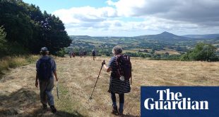
A small rural village with three pubs is a rare thing, but that’s what Waddington has – and that’s where this walk is heading. My specific target is the Lower Buck, because it’s the “real pub” – focusing on ales and socialising – where the other two have gone for food. That said, on this circular riverside amble along a historic county border you could, with a few short detours, easily have a pint in a different boozer for every mile traversed. Is that because Yorkshire and Lancashire are full of heavy drinkers, or because where there are rivers and bridges there are also inns?
We began at Chatburn – we being me and fellow walker, writer and historian Nick Burton. Nick has been a handy guide and friend since I moved to the Ribble Valley a couple of years ago and I knew he’d tramped the Ribble’s paths before. Chatburn is near where I live and since I’m still finding my feet, it made sense to start near home.

We went down a gentle slope behind the church and were soon on the left bank, approaching the first of three bridges. On crossing, we could have gone up to Grindleton village, but I had read a teasing nugget in a local book and was on a mission. So we swerved east for a mile or so along the Ribble Way, through land grazed by mules and Texel sheep and found – probably – what I was looking for: grassy humps and bumps on which flax fibres were retted (separated) and laid to dry. So much of Lancashire’s history is textiles, but linen – produced from flax – was around long before cotton became king. It’s rare to see evidence of this industry and it was a good omen for the rest of the walk.
We left the river to climb into Grindleton. For my sins I did a degree in theology and had vaguely heard of the Grindletonians – a Puritan sect led by Roger Brereley, whose masterwork was A Bundle of Soul-convincing, Directing, and Comforting Truths. I’ve become fascinated by nonconformist sects in the 17th century, perhaps because the Ribble Valley and Pendle Hill were hotbeds of religious convulsion long before political radicalism. A handy information board told us that Eccles Terrace, just off Main Street, was once called Hellfire Square, after the preachers who explained that the road to heaven was laid not by palace-dwelling bishops but by inward spiritual revolution.
Grindleton is one of many sort-of posh villages on the Ribble. On the left bank of the river are major roads there since Roman times. On the right bank, where we were, is a tangle of lanes and quaint hamlets. Every barn seemed to be undergoing conversion (owls out, nouveaux riches in). Even Grindleton’s former Methodist church is a des res, with a Lexus among the cars parked at the rear. The main Anglican church is still functioning, though, and is named for Ambrose, patron saint of beekeepers. Grindleton was once known for honey and damson jam, perhaps grog substitutes to help avoid the drop in to hell.

We headed back to the river to follow meanders that turn every mile into two. I’d chosen a river walk partly because we’d just had a cold snap and the hills and moors were still frozen. Also, the Ribble remained a mystery to me, for all that I lived close to it.
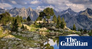
The river doesn’t pass through places so much as bypass them, and you can forget it’s there for long periods. Once the border between the kingdoms of Mercia and Northumbria, the section we were walking was, until 1974, the frontier between Lancashire and Yorkshire. Today it’s a threshold between the mill and mining towns of east Lancashire and Bowland’s bijoux hamlets and grouse estates. As we walked we caught glimpses of the latter’s fells.

Amid the aspiration are pockets of care. Bowland High School served as a camp for Kindertransport refugees from Vienna and Berlin. Near West Bradford, the second village we passed, was Heys Farm, where Mahatma Gandhi was invited to stay by millowner Percy Davies in 1931. Nick said he’d read that Gandhi got up at the crack of dawn to go down to the Ribble to say his morning prayers.
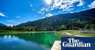
When we were there, the river was flowing fast thanks to ice melt: the Ribble’s source is close to the Yorkshire Three Peaks, which are wet and cold much of the year. Under the rushing water we could make out stepping stones – dodgy in summer, impassable in winter. On the other side were chimneys in the industrial estate outside Clitheroe. The area has a long history as a centre for quarrying and processing. Lime was the old business; today it’s chemicals and cement.

Nearing the pub we crossed a boggy hollow that looked like an old quarry, then some almshouses built for needy widows in 1700, and a perfect bench for a butty. Waddington is another pretty village and, with two Tudor-era halls, a grand one too. It’s named after Saxon chieftain Wadda; the Anglo-Saxon Chronicle says he was implicated in the murder of Aethelred, King of Northumbria, in AD 794. More famously, in 1464 Henry VI was caught by Yorkists while crossing the river on the “hipping stones”. In 1471 he died in the Tower of London, probably executed. Could you choose a more potent site for such a key point in the Wars of the Roses? Over a pint at the Lower Buck, we pondered this and toasted the region’s restive past.
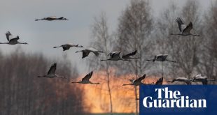
Heading back towards Clitheroe we took the old Lancashire crossing at Brungerley Bridge, which still has its pre-1974 county plaques. Beyond was another quarry, now a wildlife centre, and a sculpture trail. With more energy and daylight we might have popped into town to see the castle and high street, but we kept going. The light was dimming, but not so much that we didn’t see the blue flash of a kingfisher across the Ribble. The bird is “halcyon” in Greek, said to denote a period of fine weather between harsher times – just what we need in this time of cold and bitter realities.
Google map of the route
Allow Google Maps content?
This article includes content provided by Google Maps. We ask for your permission before anything is loaded, as they may be using cookies and other technologies. To view this content, click ‘Allow and continue’.
Start Christ Church, Chatburn
Distance 11 miles
Time 5 hours with stops
Total ascent 243 metres
Difficulty Easy
The pubs

The Lower Buck on Edisford Road, with its wooden floors and open fire, local clientele and easygoing atmosphere, is my choice for a post-hike beer. It serves real ales and is a Timothy Taylor “champion distributor” so you can always get a pint of Keighley’s finest. It also serves top-notch pies (in an area where pies are taken very seriously). Winter opening times are Wed-Sun from 3pm.
The Higher Buck is a great dining pub, with black pudding scotch egg, fish soup with Lancashire cheese, game pies and suet puddings.

The Waddington Arms is cosy and friendly, and also big on grub, with sausages from Clitheroe butcher Cowmans, steak pie laced with its own Bowland ale, and Lancashire hotpot.
The rooms
All three Waddington pubs offer rooms. The Higher Buck (doubles £110 B&B) has seven cosy, individually decorated bedrooms, with roll-top baths, original fireplaces, kettles and TVs. Two bridges along from Waddington is a grand country house hotel, Mitton Hall (doubles from £135 B&B), right on the river.