The oyster beds and sandy beaches of Britain’s most easterly inhabited island have been attracting visitors for centuries. Mersea is just a few miles south of Colchester, once Camulodunum – capital of Roman Britain – and there are Roman remains among the island’s layers of history. Bus 86 arrives from Colchester every hour, crossing a causeway called the Strood, which is often covered by water for an hour or so at high tide. But Mersea feels even more like an island if you arrive by boat, so I’m starting from Brightlingsea (bus 87 from Colchester), where a summer ferry crosses to wild East Mersea. Here the River Colne and the wide Blackwater estuary meet the tea-grey sea and strange bones emerge from crumbling cliffs.

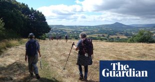
There’s an hour before the next ferry so I stroll past Brightlingsea’s lido, boating lake and beach huts to Bateman’s Tower. It’s an octagonal late-Victorian folly, built as a lighthouse for a port that never followed. I can see grazing marshes and wind-twisted woods across the water and, arriving on Mersea’s southern shore, I am soon walking past them. Huge dragonflies are hovering in tall, flowering meadows as I detour around Cudmore Grove country park, then carry on along the beach. Dark bBurgundy-sailed Thames barges drift across the horizon.

Cudmore’s low red cliffs are eroding fast, revealing fossilised sharks’ teeth and mammal bones. The wooden children’s playground includes carved hippos, a nod to the hippopotamus bones that have emerged from the 300,000-year-old gravel nearby, along with the remains of rodents, beavers, bears, wolves, monkeys and extinct, straight-tusked elephants. In 2021, Cudmore was one of the locations for Apple TV+’s adaptation of Sarah Perry’s novel The Essex Serpent with Claire Danes as a fossil-hunting Victorian widow and Tom Hiddleston as the handsome local vicar.
There are sand martins nesting in holes in the cliff, straggles of scented beach rose, yellow stars of St John’s wort and silvery sea holly. Ruined second world war pillboxes are being reclaimed by sand and shingle. In the summer of 1940, the Essex coast was fortified against possible German invasion and there are at least a dozen of these brick-and-concrete guard posts on the island. Later, I pass the Two Sugars Cafe in a converted West Mersea gun emplacement.

Coastal erosion means the route now heads inland, as far as the airy church at East Mersea, then back to the shore past a thriving vineyard. One grave in the churchyard is protected by sturdy iron hoops, presumably to stop body-snatchers; a persistent rumour that this cage is actually there to stop the deceased climbing out has led to the church’s laminated info sheet insisting that Sarah Wrench “was not a witch”. There is a palm tree by the salt-fretted tower and roundels of Flemish stained glass in some of the clear church windows.
The most famous vicar at the church of St Edmund, King & Martyr – which can date its known parsons back to Martin de Bockinge in around 1200 – was Sabine Baring-Gould, famous for writing the hymns Onward, Christian Soldiers and Now the Day is Over. He was a prolific writer, and his 1870s stint in Mersea led to a novel called Mehalah: A Story of the Salt Marshes, evoking this area “veined and freckled in every part with water”. As I trudge on along the pebbly shoreline, Baring-Gould’s description of it as desolate, but “not without beauty”, feels apt. He mentions summer carpets of pink thrift and purple sea lavender and the winter marshes “alive and wakeful with countless wild fowl”.

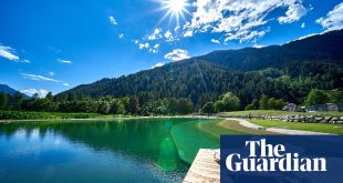
The long beach has banks of shells: cockles, mussels, sea snails and big, bleached oysters. Oysters have been grown since Roman times in the Mersea creeks, with their ideal mix of fresh and salty water. Oyster shells are everywhere, trimming flowerbeds and threaded into beach-side festoons. Further out on the low-tide mudflats, there are V-shaped lines of posts: some of these are Saxon fish traps, whose timbers have survived 13 centuries.
A pastel prism of beach huts lines the shingle near West Mersea. The tide is slowly getting higher; by evening, it will be perfect for swimming from the sandy strip at the top of the beach. When the seafront houses finally give way to reedbeds with boats ahead, I turn right up Monkey Steps to the road. Stepping inside the packed museum next door to the church, I can see weathered boards from a bronze-age walkway under glass in the floor.

Oysterman Daniel French, on the museum’s audio guide, describes how he found these planks of oak buried in the East Mersea mudflats and noticed the unusual square holes. The process of dating, preserving and displaying the boards took five years, delayed by Covid, and this prize exhibit was opened in May 2021. Nearby is a jar of bones from a Roman barrow; other displays cover beach huts and barges, fishing, farming, a stuffed curlew, an old hoop net, a penny farthing bike and a 17th-century Burmese jar for crystallised fruit, dredged from a shipwreck by a Mersea fisherman.
The freshly opened White Hart is beckoning, just over the road, with its armchairs and local beers. Tomorrow, I’ll walk past West Mersea’s oyster sheds and back to the Brightlingsea ferry along the northern shore of the island, with its marshy saltings and winding creeks, favoured by centuries of smugglers. Tonight, there’s dinner on the pub’s brick-walled terrace and local oysters on the menu.
Google map of the route
Allow Google content?
This article includes content provided by Google. We ask for your permission before anything is loaded, as they may be using cookies and other technologies. To view this content, click ‘Allow and continue’.
Start Brightlingsea
Distance 8 miles plus a ferry ride
Time 4½ hours
Total ascent 60m
Difficulty moderate
Route notes: This route relies on the seasonal foot ferry, which must be booked ahead (£4 each way, brightlingseaharbour.org). Alternatively, walk right round the island (about 12 miles), or opt for one of Visit Colchester’s shorter West Mersea walks (visitcolchester.com).
The pub

When general manager Jack Tuck first saw the White Hart, it had no roof, and had been closed and derelict for a decade. The pub’s stylish incarnation includes a vaulted contemporary dining room and a colourful lounge in the older, weatherboarded section that dates back to the 16th century. It’s only been open two weeks when I arrive and is already popular. The menu includes a “casual” section of gourmet pub classics (soup, pasta, burgers, mussels with fries), alongside an upmarket selection of seafood, saltmarsh lamb and plant-based inventiveness. In the bar, there’s a very drinkable amber Island Bitter and the malty Brewer’s Gold from nearby Crouch Vale. The terrace, with its loops of lightbulbs and tasselled umbrellas, is full of happy summer evening drinkers, lingering over cocktails, Sussex fizz and pints of Adnams’ Ghost Ship.

The rooms