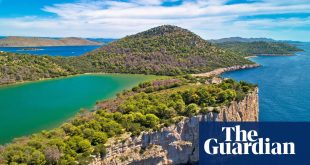
Channel Islands
Where? Jersey, Guernsey and Sark
How far? Flexible mileage; 6-10 days
Why stop at walking around one island when you could do three? Coastal paths trace the edges of both Jersey (48 miles) and Guernsey (35 miles), while on tiny Sark you can string together nine miles or so of trails to visit most of the isle’s shores. Access the archipelago by ferry, and you have a marvellous mix of sailing, coast walking, island hopping and Anglo-Gallic culture – a très belle prospect.
The Jersey loop is a combination of vast bays, high cliffs, hamlets, caves and cafes (don’t miss the crab sandwiches at Mad Mary’s in Bouley Bay). This could be spread over four days, or done in one at the annual Island Walk (17 June). Guernsey’s path, doable in three days, is a contrast of flat, sandy north and craggy, cove-cut south, with Napoleonic and second world war history along the way. Hiking around car-free Sark, a delightful day trip, is like stepping back in time.
Organise your own adventure or opt for Headwater’s new self-guided trip, which includes 70km of the best walks across all three, including the route to Jersey’s Corbière lighthouse and the second world war fortifications at St Aubin’s Bay.
How to do it Headwater’s seven-day self-guided Walking in Guernsey, Jersey and Sark trip costs from £999pp. Condor Ferries serves Guernsey (from 3 hours) and Jersey (from 7 hours) from Poole and Portsmouth. Foot passengers from £40 return.
Camino del Norte, Spain

Where? Bilbao to Santander
How long? 68 miles; 6-7 days
While the Camino Francés pilgrimage to Santiago de Compostela traverses inland Spain, the Camino del Norte sticks largely to the coast. And what a coast, quite unlike the country’s touristy stretches of overdeveloped seaside. Here, wild shores are speckled with fishing villages, world heritage sites, rocky coves, wide beaches, sidrerías (cider houses) and pintxos bars.
Starting from foodie hub San Sebastián, the full northern camino route to Santiago is about 500 miles. But in a week you could tackle the 68 miles between lively Bilbao and Santander. And you can arrive as many a medieval pilgrim did, by boat. Brittany Ferries run from Plymouth to Santander (21 hours) and Portsmouth to Santander and Bilbao (34 hours).
The camino leaves the centre of the the biggest city in the Basque region, goes over the Devils’ Bridge and passes the estuary-mouth suburb of Portugalete. It takes in the red sands at La Arena, great seafood in Castro Urdiales (try restaurant Mesón Marinero), Laredo’s medieval old town, Bareyo’s Romanesque church of Santa María, and an unfurling of rugged shores. If you’re weary, save a few miles by crossing the bay into Santander by boat.
How to do it Camino Ways has a six-night self-guided Camino del Norte trip from €606pp. Foot passengers on the Plymouth-Santander ferry from £350 return.
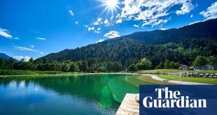
Arran Coastal Way, Scotland

Where? Brodick, Isle of Arran
How far? 65 miles; 4-6 days
You need less than a week to circumnavigate easily accessible Arran, AKA “Scotland in miniature”. This Firth of Clyde isle is divided into highlands and lowlands by the Highland Boundary Fault, making it highly diverse for its 167 square miles.
On Arran you’ll find fascinating geology, little lochs, native forests, mountains, soft sandy beaches, neolithic remains and abundant wildlife. The population is only about 4,600, but there are lovely villages to explore, including Corrie with its tiny harbour and an excellent fish bar and deli, Mara. At Machrie there are impressive standing stones, and Lochranza has a castle and a distillery.
The going is moderate to challenging, with some scrambling around boulder fields required. There are also alternative inland routes, including the option to summit 874-metre Goat Fell, the island’s highest point. When you’ve finished, head to the reception in Brodick’s Douglas Hotel to pick up your Coastal Way completion certificate.
How to do it Absolute Escapes’ six-night self-guided Arran Coastal Way trip costs from £570pp. Trains link Glasgow and Ardrossan (40 mins). CalMac ferries run from Ardrossan to Brodick.
Lake District Coast Path, England

Where? Whitehaven-Millom
How far? 37 miles; 2-4 days
The Lake District’s fells are the biggest draw for walkers in Cumbria. But maybe it’s time to reconsider the county’s coast? In 2022, a section of the newly renamed King Charles III England Coast Path opened here, making it possible to follow the work-in-progress national trail for 66 miles along the Irish Sea from Allonby to Green Road. And from summer 2023 there will be added interest. Deep Time, a series of site-specific outdoor artworks, is being installed along the shore within the Lake District national park, between Whitehaven and Millom.
Art aside, this 37-mile section makes for an excellent long weekend. There are railway stations at Whitehaven and Millom, and plenty of interest in between. This includes the raucous RSPB reserve at St Bees Head, Drigg dunes, Ravenglass’s castle and Roman remains, and vast Silecroft Beach. Before setting off, grab a bite at The Peddler, Whitehaven’s old art deco bus station, transformed into a foodie and creative hub.
How to do it Stonehouse Farm in St Bees has B&B doubles from £90 a night. The Coachman’s Quarters at Muncaster Castle in Ravenglass has doubles from £98 a night room-only. There are numerous train stations en route, including St Bees and Ravenglass.
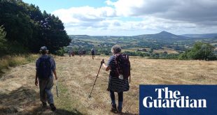
Ceredigion Coast Path, Wales

Where? Cardigan to Ynyslas
How far? 60 miles; 5-6 days
Sandwiched between Snowdonia and Pembrokeshire, the Ceredigion coast of mid-Wales is often overlooked for these higher-profile national parks. This is a shame because the coast here is an absolute joy of fishing villages, sandy coves, seafood and undulating clifftops. Also, the trail that traces this shore celebrates its 15th anniversary this year. To mark the moment, a series of 26 circular walks, each taking in a section of coast path, has been created; between now and October, a new walk will be published each week on the council’s social media.
However, at a very manageable 60 miles, why not walk the whole lot? The trail runs between the historic river town of Cardigan and the wild sand dunes at Ynyslas, on the Dyfi estuary, near buzzy Aberystwyth. It passes beautiful beaches such as Borth, Llangrannog and Mwnt. It calls at the colourful Regency harbour of Aberaeron (have a fish supper at the Harbourmaster hotel). It flirts with Dylan Thomas, passing Cei Bach beach (where the poet lived) and the town of New Quay (inspiration for his drama Under Milk Wood). And it offers excellent opportunities for spotting Cardigan Bay’s dolphins, porpoises and seals.
How to do it Celtic Trails’ six-night self-guided Ceredigion Coast Path trip from £730pp. Aberystwyth and Carmarthen have train stations. Buses link Carmarthen to Cardigan (80 mins).
South West Coast Path, England

Where? Minehead to Barnstaple/Bude
How far? 69 miles/125 miles; 6-10 days
There’s not a dull inch of the South West Coast Path, which follows England’s storied edges for 630 miles, from Minehead to Poole. But if – unlike Raynor Winn – you don’t have time for the full “Salt Path”, consider focusing on the trail’s brilliant beginning. The Somerset and north Devon stretch tends to be less crowded. This is where Exmoor meets the sea, most dramatically at Great Hangman, England’s highest sea cliff.
In a week you can make it to Barnstaple, via Raynor’s favourite bit of coast in the country: beyond the spooky ancient tree stumps at Porlock Weir lie tiny Culbone church, wooded coombs, Lynmouth harbour, the goat-grazed Valley of Rocks and hidden Heddon’s Mouth.
You’ll also get good views to the island of Lundy, traverse rocky Morte Point, soak up surf vibes at Croyde, and bimble through Braunton Burrows. Refuel at the Glorious Oyster seafood shack in Instow.
after newsletter promotion
However, if you can, add on a few extra days to finish in Bude. Taking in picture-perfect Clovelly and the rollercoaster cliffs beyond Hartland Point, this is one of the trail’s toughest but best sections.
How to do it Welcoming Myrtle Cottage in Porlock has B&B doubles from £88 a night. Hunters Inn, in the Heddon valley, has B&B doubles from £175 a night. Buses link Minehead to Taunton train station (1 hour) and Bude to Exeter station (2 hours).
Sender Mediterraneo, Spain/France

Where? Collioure in Languedoc to Cadaqués, Catalonia
How far? 55 miles; 4-6 days
The north-west corner of the Med, where the Pyrenees fizzle and France and Spain meet, is as pretty as a picture. The area’s light and landscapes have inspired artists including Dalí, Picasso and Matisse. It’s a beautiful backdrop for a walk.
Spend up to a week strolling between the chic French seaside resort of Collioure and the Catalan fishing village of Cadaqués. Walk round Phare du Cap Béar and enjoy the fruits of the vineyards in Banyuls-sur-Mer – pick up local goodies from the market too (year-round, Sundays and Thursdays). Then cross the border into Spain to trace the Costa Blanca.
The trail here is part of the GR92 (the Sender Mediterraneo) footpath network which, when completed, will run all the way to Tarifa in Andalucía. For now, wend south via the 10th-century monastery of Sant Pere de Rodes, Cap de Creus national park and its namesake lighthouse, and Port Lligat, home to Dalí’s quirky house, now the Casa-Museo Salvador Dalí. Also, the Museu de Cadaqués, which displays works by the many artists linked to the town is worth a visit.
How to do it Macs Adventure’s seven-night self-guided Collioure to Cadaqués trip costs from £895pp. London-Perpignan by rail, via Lille, takes from around 10 hours, fares from £78 one-way. Trains link Perpignan-Collioure (20 mins). Buses link Cadaqués-Figueres (1 hour); Figueres is on the Perpignan-Barcelona line.
Côte d’Opale, France

Where? Calais to Boulogne-sur-Mer, Hauts-de-France
How far? 31 miles; 2-3 days
The GR120 sentier du littoral (coastal pathway) long-distance trail runs 181 miles around northern France. Within that, from Bray-Dunes to Berck-sur-Mer, lies a stretch known as the Opal Coast on account of the way a magical light plays on its waves, dunes, estuaries, bays and beaches.
You could cover some of this sparkling shoreline over a lovely long weekend, starting by boat: this year P&O is allowing foot passengers on its Dover-Calais service again, after a ban during Covid.
From Calais, follow the sweeping coast south towards Boulogne-sur-Mer, a busy seaport and well-preserved old town, with cobbled lanes, fine buildings, a chateau museum and Philippe Olivier’s must-not-miss cheese shop. En route you’ll pass the steep cliffs at Gris-Nez and Blanc Nez, the near-endless sands of plage de Wissant, the belle époque town of Wimereux and views back to Dover’s white cliffs. This section is very tasty too – Hauts-de-France is the European region of gastronomy 2023.
How to do it Seafront Hotel de la Baie de Wissant has doubles from €115 a night, room-only. Chambres d’Hôtes du Château, within the medieval ramparts of Boulogne-sur-Mer, has B&B doubles from €140 a night. Foot passengers on the Dover-Calais ferry from £20 return. Trains link Boulogne and Calais (30 mins).
Normandy (GR223), France

Where? Carentan to Le Mont Saint-Michel
How far? 61-277 miles; 1-3 weeks
The GR223 has a fabulous finale. This Grande Randonnée leads to the abbey-topped island of Mont Saint-Michel, which rises like a fairytale at the mouth of the Couesnon River. Timed right with the tides, you can take a guided walk across the sands to reach the Mont on foot.
But where to start? It’ll take two to three weeks to walk all 23 stages of the GR223 in La Manche department, beginning at the small town of Carentan. With less time, focus on the rich natural and military history of the Carentan-Cherbourg section (61 miles): you’ll pass D-day’s Utah beach, Quinéville’s second world war museum, Saint-Vaast-la-Hougue’s impressive Vauban towers, and the flower-strewn Bessin and Cotentin marshlands.
An alternative would be to walk from the charming seaside resort of Barneville-Carteret to Mont Saint-Michel (100 miles), via Gouville’s beach huts and Granville’s seafood restaurants (head for La Table de Louis). You’ll also get exceptional views from around Cabane Vauban, called “one of the most beautiful panoramas in the world”, by General Eisenhower, whose HQ was nearby.
How to do it Camping La Ferme du Bord de Mer near Gatteville lighthouse has pitches from €11 a night. Waterfront Hôtel La Marine in Barneville-Carteret has doubles from €132 a night B&B. Portsmouth-Cherbourg foot passenger returns from £120. Trains link Cherbourg-Carentan (30 mins).
Alta Via dei Monti Lattari, Italy

Where? Cava de’ Tirreni to Amalfi
How far? 41 miles; 6 days
The Amalfi coast is one of the most glamorous shorelines on the continent, and walkers flock to tick off its beautiful (but busy) Path of the Gods day hike. However, that’s giving short shrift to this dramatic peninsula. For a deeper exploration, try the little-known Alta Via dei Monti Lattari, which traces the mountainous backbone of the Amalfi and the Sorrento peninsula, mixing crowd-free mountain walking with tremendous sea views.
The trail begins by following an old pilgrim path to the Sanctuary of Madonna Avvocata, at almost 1,000 metres above sea level. It climbs up to Monte Molare at 1,444 metres, Amalfi’s highest peak, from where you can see Capri, the Bay of Naples and Mount Vesuvius.
Eventually the route descends towards pastel-painted Positano and a scatter of timewarp hamlets to finish at the peninsula’s very tip, where Ulysses supposedly built a temple to Athena. En route lie slopes flush with wildflowers, herbs, pine trees and olive groves, views down to pretty harbours such as Ravello and Atrani, and plenty of agriturismi offering hearty portions of good food and wine.
How to do it Much Better Adventures’ new seven-night guided High Trails of the Amalfi trip costs from £1,083pp, departures from July to October. The train from London to Naples, via Paris and Turin, takes from about 21 hours; or stop over in Turin. Cherbourg and Barneville-Carteret are linked by train then bus (2 hours).